Annapurna 7 Passes Trek

From

Duration

20 days

Tour Type

5 by 3 reviews
  • Quality5
  • Location5
  • Amenities5
  • Services5
  • Price5

Overview

Annapurna 7 Passes Trek – Trekking in Nepal

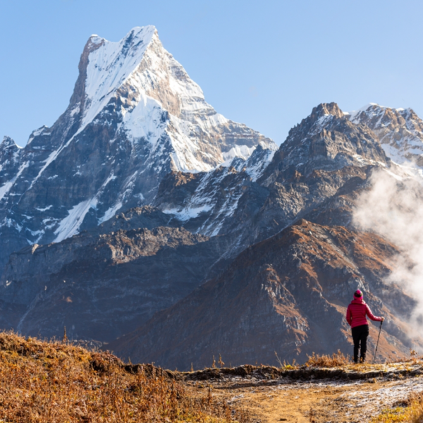
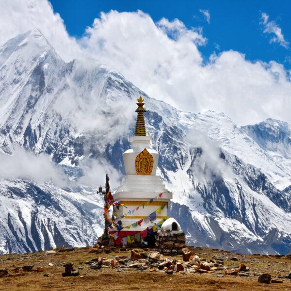
The Annapurna 7 passes trek is a fairly challenging trail. It takes trekkers through some of the most remote and breathtaking landscapes in the Annapurna region of Nepal. Annapurna region is known as the Goddess of Harvests. It includes the first and largest conservation area in Nepal. Annapurna Seven Passes Trek has recently come up as an astonishing alternative for trekkers, who want to trek longer in the peaceful wilderness of the mountains. This is a great opportunity to take on a new route while it’s still raw and untrammeled, with a mixture of camping, homestays, and tea houses along the way. The best time to do this trek is from late September to early December, or from March to May. 

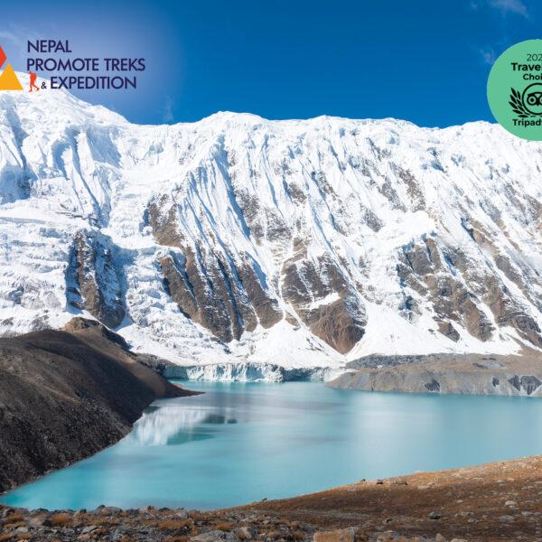
The seven passes include Mohore Pass (3,200m/10,500ft), Swarga pass (3,650m/12,000ft), Larjung pass (3,610m/11,850ft), Chekigo pass (3,730m/12,200 ft), Chogo Largo pass(4,220m / 13,850 ft )and ANNAPURNA SANASA pass (4270 m)and yak la pass(4350 m). All these passes provide you with amazing views of several 8000-meter peaks such as Dhaulagiri (8167 m), Machhapuchhre (6993 m), Annapurna I(8091 m), Nilgiri(7061 m), etc. You will get to see some of the world’s rarest animals like snow leopards, Himalayan blue sheep, etc, and Sherpa culture. 

This region is also rich in flora with over 3 thousand varieties of flowering plants. You might also come across hot springs which have medicinal properties believed to relieve various aches and pains. So if you are looking for an adventure of a lifetime then head out to Nepal for the Annapurna 7 passes trek. Also, don’t miss out the other top trekking destination in Nepal. 

 Note: The itinerary given below does not include days of arrival to and departure from Kathmandu. Trekkers need to carry their food and camping supplies for a minimum of 4 days.

Permits: ACAP and Special Permits for Naar and Phu food and camping supplies for a minimum of 4 days. 

Best time of the year: Late Spring (Late April/ May) – Autumn (October) 

Included/Exclude

  • Pick and Drop Services
  • English speaking guide
  • Entrance/ Monuments fees
  • Government & Local Fees
  • Additional Services
  • Insurance
  • International and Domestic airfare
  • Nepal entry multiple visa fees
  • Travel Insurance

Tour Amenities

Restaurant
Smoking Allowed
Wireless Internet

Tour Plan

Leave Kathmandu by 7 AM (early breakfast) for the 12-hour drive to Taal in Manang district, north central Nepal. We arrive in Besisahar roughly around noon for lunch. From here we take a local vehicle to go to Taal on a bumpy gravel road along the Marshyangdi river bank. After having our permits checked in Khudigoan, and crisscrossing across the river we arrive at Chyamje. There is a beautiful waterfall across the river here and serves as an ideal tea stop. The road to Taal is an experience in itself and offers scenic views of the green hills and terraces that are a permanent feature of the hill life. Taal is a beautiful village situated on the eastern bank of the Marshyangdi River. The village has around 300 inhabitants, most of the Gurung community. As the village has long been a part of the Annapurna Circuit there are plenty of comfortable lodges with modest basic facilities to spend the night after the long drive from Kathmandu.
Our first day of the trek begins from the sleepy village of Taal along the river bank. About an hour from Taal we come to the village of Khotro (2200m) from where the trail turns east and a steep 2.5-hour-long climb up the hill brings us to Naache, a small Gurung village with a few homestays. Although the village does not have restaurants offering western cuisine the local potatoes can be a hearty treat for a hungry trekker. [Two days' walk east from Naache can bring you to the glacial lake called Drona on the western base of Mt. Manaslu.] From Naache the trail starts descending for about 30 min before reaching a very newly established 130 m long suspension bridge across a 200m deep gorge. This bridge is the highlight of the day with views of the villages of Bagarchaap, Dharapani, and Timing far off the western banks of the Marshyangdi below the Annapurna massif can be seen from here. The trail continues along the pine forest from here. There is a very old small Bon/Buddhist monastery here for those interested in pre-Buddhist faiths of the region. A little further on the trail meets a gravel road until we come to a small suspension bridge across the Dudhkholariver to arrive at the village of Tilche, where one can meet trekkers arriving from the Manaslu trekking circuit. Ascent: 1235 m Descent: 513 m
Immediately after leaving the village of Tilche the trail can be a little confusing as one has to walk through corn and potato fields. Further on there are some narrow bushy sections on steep slopes. Less than an hour after leaving the village, there is a small cave, a few minutes below the trail. The cave has stalactites and used to host meditation in the past. After the short detour, we continue walking through the pine forest and corn fields to arrive at a suspension bridge. A short walk of 10 minutes brings us to a resting spot. We continued to walk through the forest for another 1 hr to arrive at Tachai, a small Gurung village resting at the top of a hill. The village has around 28 homestays where we will enjoy Gurung hospitality. The village also has hot spring water flowing 20 minutes walk from the village. Ascent: 2340 m Descent: 730 m
Leaving the serene little village of Tachai the trail immediately starts climbing up the slopes of the hills on the east where local goat and cattle herders take their animals to graze. A two and half hour's walk brings us to the ridge of Chong Danda from where we can see the village of Ghalinchowk in the far south. It is also not uncommon to see Langoor monkeys jumping from branch to branch, magnificent mountain goats posing from behind the bush, and gangs of Yellow Billed Coughs chasing Flying Squirrels from tree to tree. The trail then starts heading down to the Chong river before heading higher up the valley where the tall pine trees give way to smaller birch trees and white, blue, and purple rhododendron bushes. After having lunch on the banks of the river we head towards the Shingle Kharka, our camping spot for the night, located in the valley between two large rocky ranges. This is also the grazing ground for yaks and we come across lonely herders who welcome you with curiosity and a big smile. The yak herders can be a great source of information on the condition of the trail further up. Ascent: 1250 m Descent: 54 m
Starting from Shingle- the trail disappears into the rugged mountain in the northeast. As we climb up the rocks towards the first of our passes, you can see the Annapurna range in the distant west while the valley below comes to life with the bells of the yaks and the barking of their shepherd dogs. About 45 minutes later we came to a small shepherd hut. We continued our climb towards KuchumroPhedi at an altitude of 4525 m where we spent our camp for the big climb the next day. Ascent: 814 m Descent: 62 m
DAY 6: KUCHUMRO PHEDI – KUCHUMRO PASS – YARCHA PASS – NAMAKYU 4445 M, DURATION: 10hrs We have now entered into the domain of the yak herders and Yarchagumba (Cordyceps Sinesis) harvesters. In late spring people from near and afar come to the grassy slopes above 3000 m all over the Himalayan range spending a few weeks camping there collecting the precious caterpillar fungus (Cordyceps Sinesis) or Yarsagumba. We gear up for a long uphill until we cross the Yarcha Pass. The day starts with views of Mt. Manasalu towards the east and Lamjung and Annapurna towards the west. A walk of about 2.5 kilometers brings us to the top to be rewarded with amazing views of the Manaslu and Lamjung range as we make past Kuchumro. The snowy pass requires proper equipment like gaiters and crampons. Once we pass the Kuchumro pass (54900 m), we walk down for about 30 minutes to start uphill to cross the Yarcha pass (4860 m). As we cross Yarcha pass, we are rewarded by the views of KangaruHimal (6941 m) and Annapurna II. We continue walking downhill to arrive at Namakyu (4595 m) where we spend our overnight after a long walk. We will camp by the riverside directly facing the LamjungHimal and the view of KangaruHimal. Ascent: 1144 m Descent: 693 m
Wake up early for the early morning views of LamjungHimal, Annapurna II, and Gangapurna towards the southwest and KangaruHimal facing top towards the north. The clear sky with the views of mountains makes it a perfect ambiance to start your day. After breakfast, we walk for about 10 minutes uphill and then descend for another 15 minutes to cross a small glacial river. We cross the river for a gradual uphill facing Annapurna II and keeping KangaruHimal at the back. As we ascend for 2 hrs. We are greeted by the views of Pisang peak standing majestically above the Pisang monastery from where we take a gradual walk facing Pisang to arrive at the Meta pass (4800 m). Pack lunch is recommended today as there is a shortage of water before the pass. After lunch at the pass, we start to descend toward Meta. It takes about 4 hours to reach Meta from the pass. We arrive at a river with a small bridge from where we start to ascend for another 1 hr to reach Meta – a small village with few houses. Ascent: 566 m Descent: 1450 m
Today is a moderate but long walk. We get the early sunrise view of Lamjung Himal on the south and Pisang peak towards the west. After breakfast, we start with a gradual easy walk with a view of Pisang monastery on the other side of the hill. As we walk higher north we enter into the trans-Himalayan region which is much drier. About an hour's walk from Meta we come across the first of the former settlement of the Khampa people in a place called Jhunum which is now used as a winter home by residents of Naar village. The Khampa are people from the Eastern Tibet who was waging a guerrilla war against the Chinese in the 1960s used Nepali territory in Manang and Mustang as their base. The trails continue across a glacial river and arrive at another Khampa settlement at Chyakhu. The ruins of the former settlement of the Khampa are testimony to their ability to adapt to life in the high Himalayas as can be seen by the canals they had built to irrigate their fields. (Recommend reading: Buddha’s warrior for more info on the Khampa war). We walk further with a gradual uphill and then descend to arrive at a small bridge to cross the river from where we start ascending for about 20 minutes to arrive at Kyang, another Khampa settlement, located safely between two large rocky outcrops. After lunch, the trail starts being carved out of the cliff and we continue on this trail with Phu River on the left side for another 3 hrs to meet a wooden bridge. Cross the bridge and continue walking. During the monsoon, if the river is high we continue walking on the same side instead of crossing the bridge. As we approach the final ascent for Phu, we arrive at a big canyon from where a straight uphill of 15 minutes brings us to the old gate. As you walk along the river on the left are the remains of an old fort that would have served as a lookout point in the days past. A little further ahead is a long mani wall while a glimpse of Phu in the distant cliffs comes into view. A little ahead is a suspension bridge leading across the river and into Phu village. Ascent: 1213 m Descent: 1030 m
Phu is a village that takes you back somewhere in time. From a distance, it looks as though the village has been carved out from the hills behind it with the stone buildings almost being camouflaged by a cliff. The houses are built with rock and timber with mud plasters though there are now a few modern houses. The TashiLakhang monastery about 30 minutes from the village in Phu, is one of the oldest in the region and was famous for the edict by the late Rimpoche or head monk who on request by the villagers only accepted to stay back if they promised that the village would ban alcohol and tobacco. To this day sale and consumption of tobacco are forbidden in the village although the cold couldn’t keep the alcohol away. As we leave Phu village and start climbing we are served with the views of Himlung Himal and KangaruHimal. the trail climbs up towards Phu Pass for 3 hours from where we can get splendid views of Mt. Himlung with the glacier in the northeast as well as Mt. Khangru in the south. From the top of the pass, the trail descends to the river for about 3 hours until we reach a bridge from where we start walking for approximately an hour to reach the yak herder's camping area known as Loang. Ascent: 830 m Descent: 164 m
Wake up in the morning to the views of Himlung and Kangaru peaks. The trek starts with an ascent of the Naar pass. The view of Himlung and KangaruHimal stays with us until we reach the top of Nar pass (5400 m) which takes about 3 hours. As we approach the pass, the scree fields make it rather challenging to reach the top. However, once we are there a 360* view of the mountains including Bhrikuti, Himlung, and Kangaru towards the east, and the Chulu and Annapurna range towards the southwest greets us. We then descend from here to lose about 1400 m through the scree field to arrive at Checkchu where we camp for the night. Ascent: 443 m Descent: 871 m
After breakfast, we start to descend for about 1 hour until we reach a suspension bridge. Another two hours of slow ascent along the river brings us to a small valley surrounded by tall cliffs with natural caves in it. A steep uphill here for another 3 hrs will bring us to the beautiful Naar village. Ascent: 315 m Descent: 871 m
On an easy day today, we can visit the Nar Village and the surrounding after breakfast. We will leave Nar village after lunch, taking an easy walk from Nar through the Pisang valley with Pisang peak on the left side and other snowcapped mountains on the right. We arrive at the Kang La Phedi (4530 m) after 3 hrs walk and camp there. Ascent: 325 m Descent: 18 m
The top of the Khangla Pass at 5413M probably offers some of the best 360* views of the entire trek early in the morning. On a clear day, we can see the smaller peaks of the Chulu range in the northeast, Manaslu in the southeast, Pisang peak in the south, and the Annapurna range in the west. From the base of the pass, we first cross a small glacial stream before starting our 3-hour ascent to the top, near which is a small glacial lake. As we walk down from Khang La, first through a scree field, and then the grassy slopes where herders bring their animals to graze, the Marshyangdi Valley and the Annapurna range loom large in front of us. We can even make out the runway in the airport in the town of Humde down in the valley. The walk to Ngawal from the top of the pass takes about 3 hours. Ascent: 1263 m Descent: 1935 m
Our rest day at Ngawal today can be spent walking around the village of Ngawal and meeting local people and interacting with them. This small village has a population of roughly 300 people and offers splendid views of the Annapurna range looming above the Marshyangdi river valley in the west.
Continuing on the south side of the river, the trail includes a long climb over a ridge that passes through Upper Pisang via Ngawal as it guarantees outstanding views of Mt. Annapurna, Pisang Peak. On the way, we pass through pine forests, villages such as Braga, and farming terraces. As we walk near Manang, the climate becomes more cold and dry.
We continue our trek towards the base of the pass that is Thorong La and climbs steadily through Tenki and leaving the Marshyangdi Valley behind. As we continue along the JarsangKhola Valley we arrive at the small settlement of Ledar at an elevation of 4250M.
From Ledar to the trail to ThorongPhedi is a gradual ascent past towering cliffs and rockfalls. On the way, we go through the outstanding views of Mt. Ghundang, and Mt. Syagang. Although the day is not that long, it is better to reach ThorangPhedi early and rest as the walk the next day can be long and exhausting with many trekkers heading up the Thorang Pass as early as 3 AM to make the most of the day.
The trail becomes steep as soon as we leave ThorongPhedi. Following rocky ridges, as it ascends to the Thorong La pass (5416M), the Great Barrier Ridge appears. From the top of the pass, we can get the first glimpses of the other side of the Annapurna which gives an idea of what Tibet must look like. The walk down from the pass is long and exhausting although it is just walking downhill. Muktinath (literally Lord of Emancipation) is considered holy by Hindus and Buddhists and draws pilgrims from all over. The temple complex has 108 stone water spouts from where the pure waters of the mountains flow out. Hindus believe that a shower through all the 108 water spouts washes your sins. The Buddhist shrine which is believed to be much older has a natural flame inside that is probably fueled by natural gas from inside the earth.
Although this is the last day of the trek, and getting to Jomsom by vehicle is much faster, the walk down can be leisurely as there is no uphill climb. The stretch from Muktinath to where the road meets the river near Kagbeni gives us a glimpse of the high-altitude desert terrain that opens towards the Tibetan plateau further up north. The region is a dry arid landscape with high snow-covered peaks like Tilicho Peak and Nilgiri in the south and Dhaulagiri to the west. Walking down we cross the villages of Jharkot and Kagbeni, the gateway to the once-forbidden kingdom of Lo Manthang. Kagbeni has a magnificent old monastery and some superb lodges and restaurants and is worth the lunch stop. Jomsom, is about 3 hour's walk away, along the banks of the Kali Gandaki river where strong gusts of the wind almost push you back. The town has an airport but due to the wind factor flights can only land in the first half of the day.
We take an early morning flight from Jomsom to Pokhara and catch a connecting flight back to Kathmandu.

Related Tours

Review Scores

5/5
Wonderful
3 verified reviews
Quality 5/5
Location 5/5
Amenities 5/5
Services 5/5
Price 5/5

3 thoughts on “Annapurna 7 Passes Trek”

  1. 5

    • Quality
    • Location
    • Amenities
    • Services
    • Price

    This is really good

  2. Georgiana June 19, 2023

    5

    • Quality
    • Location
    • Amenities
    • Services
    • Price

    Hello there! Would you mind if I share your blog with my zynga group?

    There’s a lot of folks that I think would really enjoy your content.

    Please let me know. Thank you

  3. Bennie June 22, 2023

    5

    • Quality
    • Location
    • Amenities
    • Services
    • Price

    whoah this weblog is excellent i love reading your
    posts. Keep up the great work! You already know, many people are looking around for this
    information, you can help them greatly.

Add a Comment

Your email address will not be published.

  • Quality
  • Location
  • Amenities
  • Services
  • Price

Booking Tour

Tour Information

Max Guests

14

Min Age

5 +

Tour Location

Languages Support